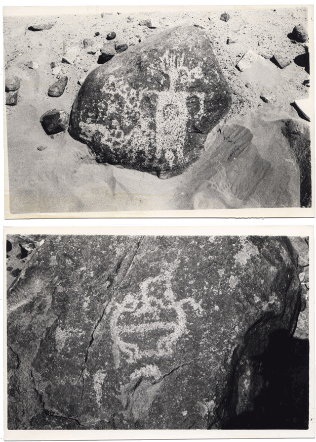
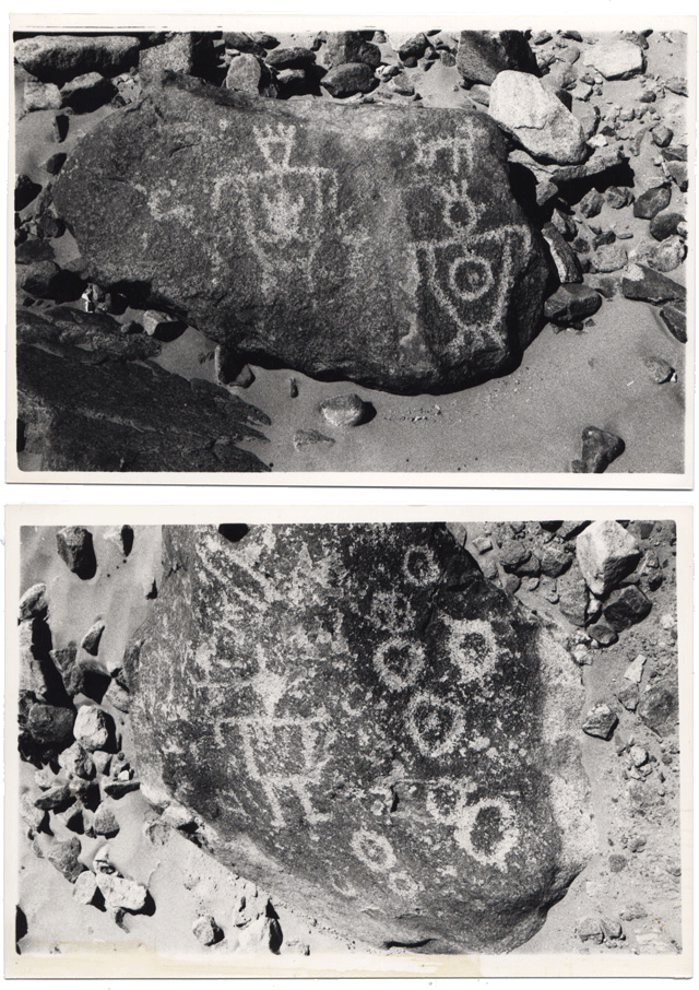
Petroglyphs located in between Huarasina and Quillaguasa (Tarapacá, Chile)
This site lies within a vast field of ancient landslide boulders, where hundreds of engravings have been carved into darkened rock surfaces. The petroglyphs depict human figures in motion, animals, and solar and geometric symbols, suggesting a place of ritual activity and ceremonial gathering.
Archaeological evidence, including pottery fragments and food remains, indicates that people stayed here for extended periods, performing rites that likely involved communal meals and offerings. The carved stones are scattered across the landscape, each possibly serving as a localized shrine for different groups or families, while nearby alignments of upright stones hint at a more formal ceremonial space.
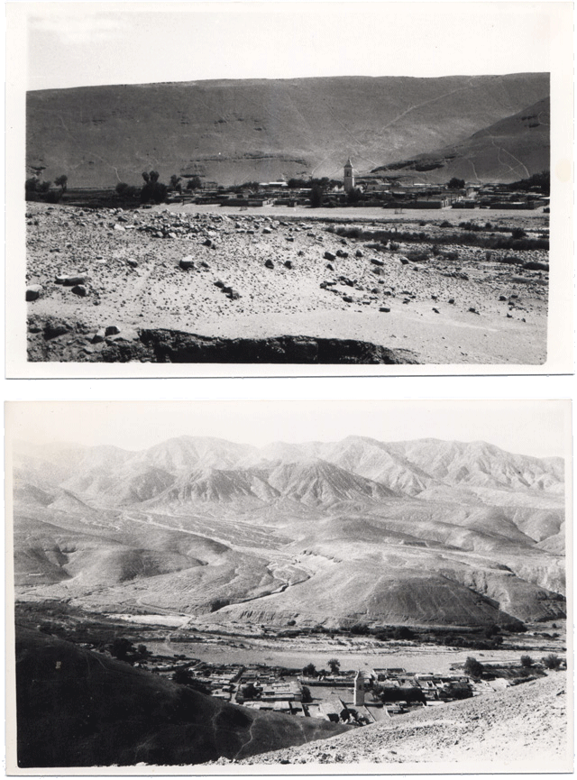
In the vicinity lies a small village overlooking the “Gigante de Atacama,” a monumental anthropomorphic geoglyph comparable in scale and intention to the Nazca Lines. Across the nearly dried-up river are additional archaeological remains, including a prehistoric burial site.
The sanctuary is located close to the historic village of Tarapacá, where religious gatherings still take place today, suggesting a long continuity of sacred use in this landscape from pre-Hispanic traditions to the present.
Map coordinates: 19° 55' 34.11" S, 69° 30' 24.18" W
Photo: Jan Giliam © 1989
More information: eco-antropologia.blogspot.com.
This site lies within a vast field of ancient landslide boulders, where hundreds of engravings have been carved into darkened rock surfaces. The petroglyphs depict human figures in motion, animals, and solar and geometric symbols, suggesting a place of ritual activity and ceremonial gathering.
Archaeological evidence, including pottery fragments and food remains, indicates that people stayed here for extended periods, performing rites that likely involved communal meals and offerings. The carved stones are scattered across the landscape, each possibly serving as a localized shrine for different groups or families, while nearby alignments of upright stones hint at a more formal ceremonial space.
In the vicinity lies a small village overlooking the “Gigante de Atacama,” a monumental anthropomorphic geoglyph comparable in scale and intention to the Nazca Lines. Across the nearly dried-up river are additional archaeological remains, including a prehistoric burial site.
The sanctuary is located close to the historic village of Tarapacá, where religious gatherings still take place today, suggesting a long continuity of sacred use in this landscape from pre-Hispanic traditions to the present.
Map coordinates: 19° 55' 34.11" S, 69° 30' 24.18" W
Photo: Jan Giliam © 1989
More information: eco-antropologia.blogspot.com.